BLAKLENS
Connected visual communication systems for construction, renewable energy and environmental intelligence.
C.L.E.E.R. Connections sits behind BLAKLENS as the capability and delivery business — providing field deployment, visual communication, remote connectivity and project/environment monitoring experience.
Aboriginal Business
Creating a stronger pathway for clients seeking meaningful Indigenous participation in project and environmental monitoring.
Supply Nation Certified
Supports procurement confidence for Government, infrastructure, renewable energy, mining and environmental programs.
Visual Communications
Project photography, timelapse, drone, virtual and remote viewing outputs.
ExploreConnected Systems
Solar, 4G, Starlink, dashboards, camera systems and remote support workflows.
Projects & Environment
Construction visibility, renewable energy project visibility and environmental intelligence under one framework.
BLAKLENS Deployment
Site-ready systems designed to reduce friction, simplify coordination and deliver useful visual data from day one.
Project Visibility. Simplified.
Quick deployment — sent direct to site. Self install. View in minutes. Not just a camera — a project visibility platform.
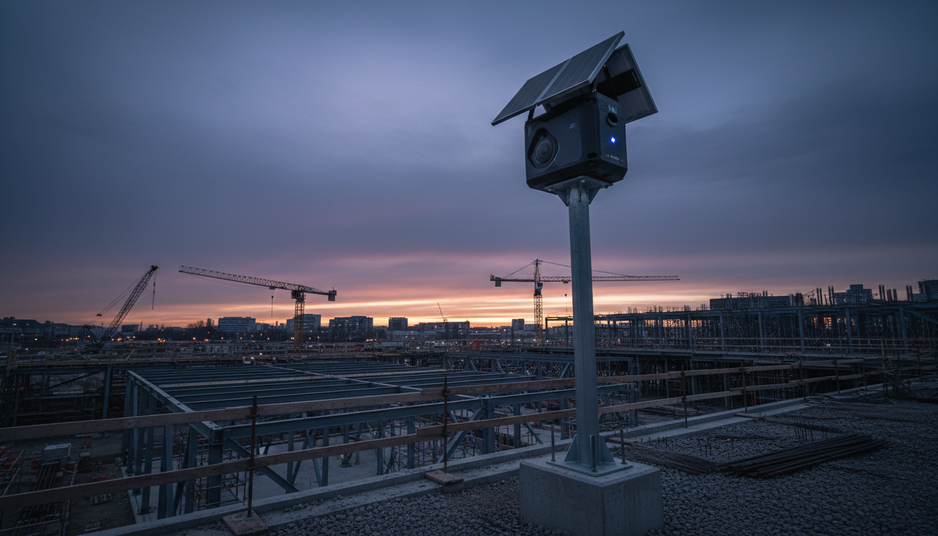
BLAKLENS Project Cameras are designed for fast, practical project visibility without the complexity of traditional camera installations. Compact and lightweight — approximately the size of a Rubik's Cube — they combine rugged camera hardware, self-install capability, remote access, live viewing, scheduled video creation, AI-powered analytics and managed support within one project-ready platform.
Portable Self-Install
Sent direct to site with a guided setup pathway so project teams can get visual access quickly.
ExploreSolar-Assisted Power
10–20W solar plus battery pack options support efficient long-term unattended monitoring.
ExploreCamera Options
12MP with 105° field of view, plus 64MP and thermal camera options for higher detail.
ExploreDashboard & Gallery
Remote project image access, viewing history, gallery links and a single place for stakeholders.
ExploreLive Streaming
Live viewing and scheduled video creation options help teams communicate progress in real time.
ExploreAI Analytics
AI-assisted review for progress tracking, safety observations and environmental compliance.
ExploreBenefits for Construction Managers
Strengthen Team Communication
Eliminate confusion by sharing clear, real-time visuals. Decisions are made faster — reducing downtime and costly rework.
Keep Projects on Schedule
Gain live visibility into daily progress and detect potential bottlenecks early. Maintain control, prevent delays and stay on budget.
Optimize Resource Allocation
See exactly where labour and materials are over- or under-used. Streamline operations and maximise ROI.
Enhance On-Site Safety
Monitor activities around the clock and address risks proactively. A continuous visual record supports compliance.
Reassure Stakeholders
Provide investors and decision-makers with clear visual updates. Consistent transparency fosters trust.
Renewable Energy Projects
Use BLAKLENS Project Cameras across large or distributed energy sites where project teams need remote visibility, progress evidence and stakeholder updates.
Use Cases & Applications
Environmental Intelligence. Connected.
A deployable environmental camera network designed to capture wildlife, habitat and environmental activity across large and remote areas.
BLAKLENS Enviro is not simply a trail camera program. It is designed as a scalable field intelligence network, combining field cameras, long-range wireless connectivity, solar-powered base infrastructure, Starlink backhaul, weather data, cloud storage and AI-assisted image review into one connected monitoring platform — particularly valuable for threatened species monitoring, environmental offsets, mining rehabilitation and Indigenous ranger programs.
10–100 Cameras Per Base
Scalable monitoring coverage for site-specific environmental programs.
Long-Range HaLow Network
Designed to transmit imagery back to a base station across broad field areas.
Starlink Backhaul
Remote connectivity for sites where standard mobile coverage is limited.
AI Species Review
Classification workflows designed to reduce manual image sorting.
Weather Integration
Connects imagery with temperature, rainfall, wind and site conditions.
Cloud Dashboard
Secure access to images, status, filters, trends and reports.
Enviro Applications
Engagement Models
Pathways and quotes provided after scope, site conditions, connectivity and support requirements are understood.
Client Resources
Product briefs, brochures and quick start guides.